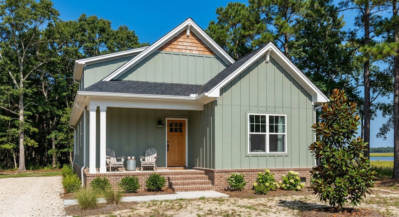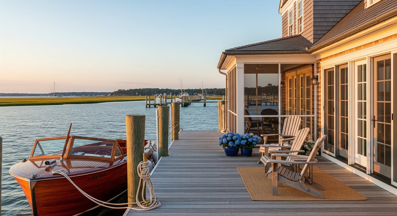
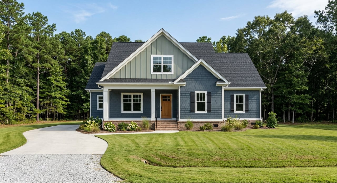
Imagine waking up to quiet water views and coffee on your future dock. If you are shopping for land in Lancaster to build a custom river country home, the shoreline, soils, and permits shape what you can do and how long it will take. The right plan helps you protect your budget, avoid delays, and place your home for the best views and privacy.
This guide walks you through how to screen parcels fast, confirm septic and well viability, plan for waterfront and access permits, and build a realistic timeline. You will also learn where an experienced advisor can save you time and stress. Let’s dive in.
Start with maps and fast filters
Your first pass should be a map review before you spend on surveys or design. Use the Lancaster County GIS to see parcel lines, zoning, soils, and FEMA flood layers in one place. The county GIS helps you sketch a rough buildable envelope and spot red flags early. Check the parcel in the Lancaster County GIS.
Add a wetlands screen. The USFWS National Wetlands Inventory is a national tool that highlights likely wetland areas, especially along tidal shores. It is a screening resource, not a legal delineation, but it is useful for narrowing options. Review potential wetlands with the National Wetlands Inventory.
As you screen, note any mapped flood zones and base flood elevations. These influence foundation type and insurance and can affect where the county will allow clearing and grading.
Know the Chesapeake Bay RPA rules
Lancaster implements the Chesapeake Bay Preservation Act locally. Resource Protection Areas include tidal wetlands, tidal shores, and a 100‑foot vegetated buffer. Activity in these areas is tightly limited and may require exceptions, mitigation, or alternative siting. For definitions and local guidance, review the county’s comprehensive plan and ordinance material in the Lancaster Comprehensive Plan.
Why this matters to you: an RPA line that crosses a parcel can shrink the buildable area, push you to elevate the home, and influence septic choices. You want to place the house to capture views while staying outside restricted buffers wherever possible.
Septic and well feasibility comes first
If the lot is not on public sewer, your home depends on a permitted onsite sewage system. In Lancaster, onsite sewage and private well approvals run through the Virginia Department of Health’s Three Rivers Health District. Most buyers hire an Authorized Onsite Soil Evaluator or licensed soil scientist to dig test pits and design a system under VDH oversight. Start with the local office listed by the Three Rivers Health District.
Soils drive the solution. Conventional gravity systems fit certain textures and depths. Marginal or wetter soils may require engineered alternatives such as mounds, shallow drip dispersal, or advanced treatment units. Regional septic guidance for the Chesapeake Bay watershed explains why site‑specific testing is decisive. For background on system types and soil considerations, see the Chesapeake Bay OWTS Expert Panel report.
Plan your timeline accordingly. VDH reviews and alternative system designs can add weeks to months. A written feasibility letter or permit path from VDH before you close is one of the smartest moves you can make.
Waterfront work and wetlands permits
If you plan a pier, boat lift, shoreline stabilization, or any work in or near tidal waters and wetlands, most projects use the Tidewater Joint Permit Application. This one application coordinates review among the U.S. Army Corps of Engineers (Norfolk District), the Virginia Marine Resources Commission, the Department of Environmental Quality, and the local Wetlands Board. Learn what activities the process covers on the USACE Tidewater JPA page.
Expect public notice and, in some cases, site inspections and hearings. Siting, water depth at mean low water, submerged aquatic vegetation, and shoreline type all affect what is allowed and whether a living shoreline is preferred. Early contact with county staff and VMRC shortens review time and helps you plan your dock and access with fewer surprises.
Driveway access and VDOT entrance rules
If your driveway will tie into a state‑maintained road, you will need a VDOT entrance or land‑use permit. VDOT controls sight distance, culvert and drainage design, and entrance geometry for safety. They can require changes or shoulder work at your cost. Review the state’s entrance permitting framework in the Virginia Administrative Code summary.
The entrance location can influence where you place the house and how much you spend on culverts or fill. Call the local VDOT residency early to confirm what they will approve.
Utilities and broadband checks
Confirm where you will connect to power and internet before you finalize a site plan. Much of the Northern Neck is served by Northern Neck Electric Cooperative, and some areas also have Dominion Energy. Contact the utility to confirm transformer capacity and any extension costs. You can find NNEC contact information via the Northern Neck Electric Cooperative listing.
Lancaster County has an active Broadband Authority coordinating fiber projects with partners such as All Points Broadband. Fiber availability can be a lifestyle and resale driver if you need modern home office capability. Check project updates on the Lancaster County Broadband Authority site.
Recommended due diligence sequence
Follow an order that reduces risk and helps you make go or no‑go decisions early. Here is a practical path you can use for most parcels:
Map screen and basic title review. Pull the parcel on the Lancaster County GIS to review zoning, soils, RPA overlays, and FEMA flood layers. Ask your closing attorney to review the deed and any riparian or utility easements.
Phone pre‑checks. Call Lancaster Planning and Land Use, Environmental Health at Three Rivers, the VDOT residency office, and Wetlands Board staff. Describe the parcel and your concept to confirm likely submission requirements.
Boundary survey. Commission a certified boundary survey that shows mean high and mean low water lines if the lot is waterfront. You will need an accurate survey for dock permitting and a clean site plan.
Soils and septic evaluation. Retain an AOSE or licensed soil scientist to dig test pits and prepare a concept. Submit for a VDH feasibility letter through the Three Rivers Health District. Plan for engineered options if soils are marginal.
Utilities check. Confirm the nearest transformer, potential extension costs, and timing with the utility. If broadband is essential, verify current and planned service using the Lancaster County Broadband Authority.
Waterfront pre‑application. If you plan a pier or shoreline work, open a pre‑application conversation and prepare the Tidewater JPA. Read process details on the USACE Tidewater JPA page.
Builder and schematic design. Select a builder experienced with coastal foundations and local permitting. Share your survey, soils report, and any septic or shoreline constraints before drawing plans.
Permit submissions. Once you have septic authorization and a schematic site plan, submit building and land‑disturbance permits through the county’s online permit portal.
Budget and timing watchouts
- Do not rely on listing maps alone. Verify FEMA flood zones, soils, and RPA overlays on the county GIS. A quick check can save you from an unbuildable plan.
- Do not assume an old dock or bulkhead was permitted. Many were built years ago without formal approvals. Research the Tidewater JPA process on the USACE site and request any prior permits before you buy.
- Expect septic complexity. Coastal Plain soils vary across Lancaster. Site tests determine whether you can use a conventional system or will need an engineered alternative as described in the OWTS Expert Panel report.
- Build extra time into your schedule. Multi‑agency JPA reviews and VDH permitting can add weeks to months. Planning ahead keeps your foundation and dock work on track.
Placing the home for views and resilience
Once feasibility is clear, fine‑tune siting for everyday living and long‑term durability. Use your survey and flood data to choose the right foundation type and finished floor elevation. This often means balancing water views with sensible grading and storm readiness.
Keep vegetation that protects the shoreline where RPA rules require buffers. Where access to the water is allowed, plan a simple, direct path that avoids wetlands and sensitive areas. These choices protect your shoreline and support a smoother permit path.
How an experienced advisor helps
A construction‑savvy advisor streamlines the process and reduces risk. You benefit when someone can:
- Pre‑screen parcels on the county GIS and wetlands maps to flag problems before you post earnest money.
- Translate soil and test‑pit results into realistic septic options and coordinate with VDH and AOSE professionals through the Three Rivers Health District.
- Sequence JPA and county permits so septic, foundation, and dock timelines do not block each other. Read the coordinated process on the USACE Tidewater JPA page.
- Anticipate VDOT entrance requirements that influence driveway, culvert, and drainage costs under the state entrance rules.
If you want a river country retreat that fits your lifestyle, a clear plan from map screen to move‑in gives you confidence at every step.
Ready to explore Lancaster land with a smart, build‑first approach? Schedule a personalized market consultation with Beth Groner to plan your search, confirm feasibility, and move forward with confidence.
FAQs
What should I check first when buying land in Lancaster, VA?
- Start with the Lancaster County GIS to review zoning, soils, FEMA flood layers, and RPA overlays, then confirm wetlands using the National Wetlands Inventory.
How do Chesapeake Bay RPA buffers affect where I can build?
- RPAs include tidal wetlands, tidal shores, and a 100‑foot vegetated buffer, which tightly limits clearing and construction; review local guidance in the Lancaster Comprehensive Plan.
How do I confirm septic feasibility for a rural lot?
- Hire an AOSE or soil scientist to perform test pits and submit results to the Three Rivers Health District for a feasibility letter; system type and timing depend on soils as outlined in the OWTS Expert Panel report.
Who permits a private pier or shoreline work in Lancaster County?
- Most projects use the Tidewater Joint Permit Application coordinated by USACE, VMRC, DEQ, and the local Wetlands Board; see the process on the USACE Tidewater JPA page.
Do I need VDOT approval for my driveway in Lancaster?
- Yes, if your entrance connects to a state‑maintained road, you will need a VDOT entrance or land‑use permit under the state entrance rules.
How can I verify power and broadband for a rural parcel?
- Contact the electric utility listed for your area, such as Northern Neck Electric Cooperative via the NNEC listing, and check fiber status with the Lancaster County Broadband Authority.